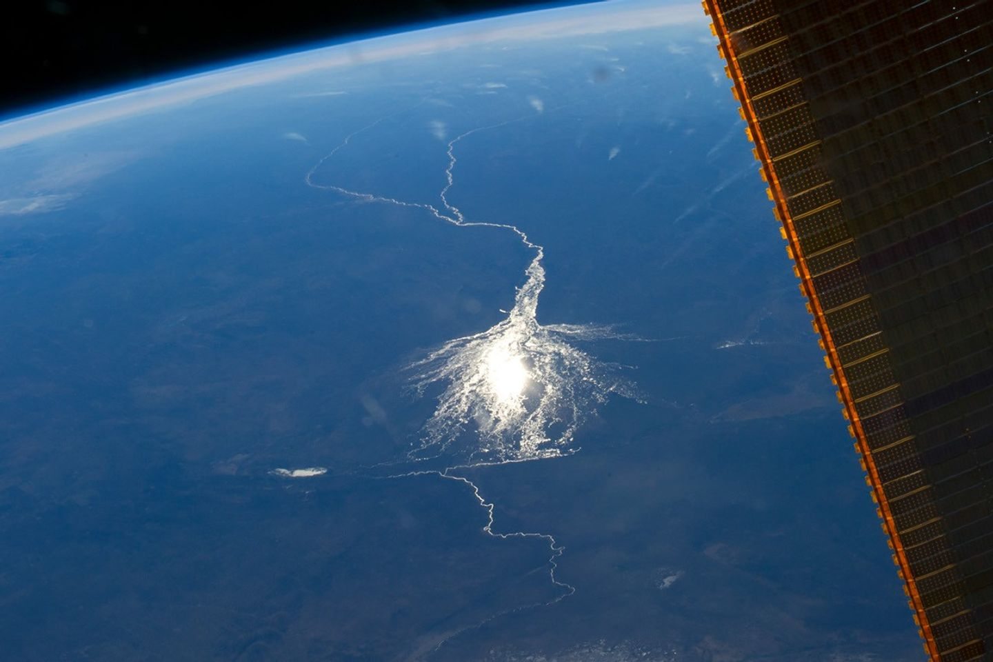
Sunglint on Okavango Delta waterways photographed from the ISS

YOUR.earth / Living Earth Network ambition

SEE THE RISK.
KNOW THE LIFE.
RESTORE THE PLACE.

Connect the view from space with the evidence in a water sample—and the people who can turn both into action.

Space Nature Risk Analysis

Technology with
its feet on
the ground.

Proposed programme / not a live monitoring service

The aim is a connected evidence-to-action system for landscapes: screen the risks, investigate what lives there, fund the priorities and return to learn what changed.

YOUR.earth organises investment in the landscape where a business operates. Its Living Earth Network model connects scientific interpretation, restoration funding and local implementation. Those responsibilities stay visible and distinct.

Our starting point is to work with existing Earth-observation data and qualified scientific providers. The orbiting satellite illustrates that connection; it is not a claim of a Mauroo-owned spacecraft or an active satellite service.

01

Screen from space.

Use suitable satellite imagery and environmental layers to examine land cover, habitat connections, vegetation change and water patterns. Combine them with the locations and dependencies of projects to prioritise questions for the field.

02

Read the biological evidence.

Environmental DNA is genetic material left in water, soil and other environmental samples. Appropriate sampling and laboratory analysis can help detect organisms. Pair it with habitat surveys, local knowledge and, where useful, bioacoustics.

03

Fund a practical response.

Turn evidence into a locally agreed plan. Identify interventions, permissions, delivery teams, maintenance and budget. YOUR.earth’s role is to organise restoration funding and clear allocation arrangements.

04

Deliver in the landscape.

Local organisations, conservation specialists and implementation partners carry out the work. Depending on the place, that could mean water retention, agroforestry, habitat corridors or restoration around energy infrastructure.

05

Return. Measure. Adapt.

Repeat observations at suitable times with comparable methods. Keep spending, completed work and ecological results separate. Use the findings to adjust the plan and report uncertainty.
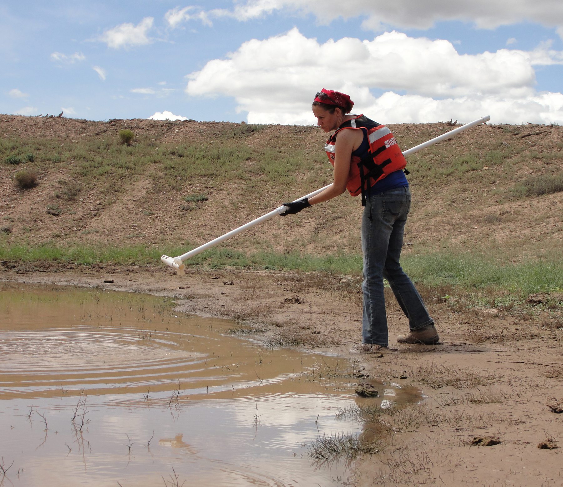
USGS scientist collecting pond water for environmental DNA analysis USGS environmental DNA sampling / method reference

A world of evidence in a sample

SMALL TRACES.
BIGGER
UNDERSTANDING.

eDNA brings a biological lens to the landscape. The ambition is to make scientific evidence part of the same decision process as project development, restoration funding and field delivery.

That begins with the ecological question, a suitable sampling plan and independent specialist interpretation.

The logic

Satellites show patterns.
eDNA adds biological evidence.
People turn knowledge into recovery.

A real place to connect the thinking

WATER SECURITY.
SOUTHERN NAMIBIA.

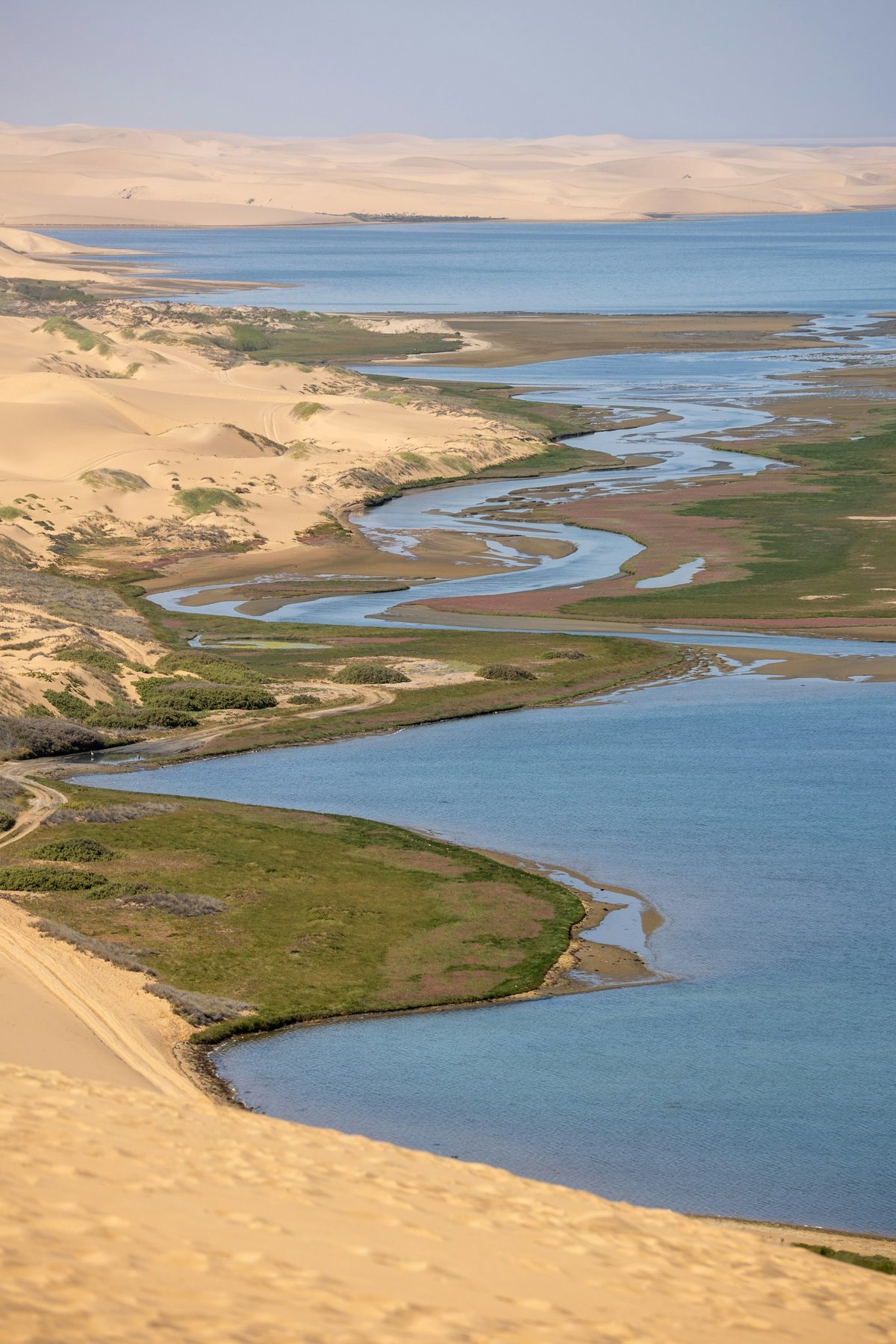
Coastal water channels in Namibia; regional context, not the water project location

Regional context photography.

YOUR.earth and Acacia Water are working on research and programme development around Keetmanshoop and the Löwen sub-catchment.

A possible extension would be to screen catchment conditions from space, agree priority locations with local and water specialists, and design appropriate field and biological sampling. Those observations could then guide practical interventions and repeated monitoring.

This describes how the proposed intelligence model could connect to existing work. Satellite risk analysis and eDNA sampling are not presented as already deployed in this programme.

See the current water programme

Our scientific partner

NatureMetrics ↗

THE SCIENCE
BEHIND THE
BIG PICTURE.

From screening nature risk to understanding the biological evidence, NatureMetrics brings specialist nature intelligence to the partnership.

Global Nature Risk

Screen locations and portfolios to prioritise where deeper ecological investigation is needed.

eDNA & bioacoustics

Bring biological observations into the assessment through environmental samples and acoustic monitoring.

Insights & the intelligence platform

Interpret species and habitat evidence and organise information for decisions across sites and over time.

Explore our partner’s science

NatureMetrics provides scientific expertise. YOUR.earth connects programme funding; local organisations and implementation partners deliver field work. Each programme needs its own agreed scope and monitoring plan.

Scientific clarity

BIG AMBITION.
RIGOROUS EVIDENCE.

The view from above and the sample from below answer different questions. Neither tells the entire story alone.

Resolution and timing matter.

Clouds, image resolution, seasonal change and model uncertainty affect Earth-observation interpretation. A green pixel is not a biodiversity inventory.

A detection needs context.

eDNA results depend on sampling, transport, controls, reference libraries and laboratory methods. Detection does not automatically establish population size; non-detection does not prove absence.

Independence matters.

NatureMetrics is our scientific partner for nature intelligence. The programme model keeps scientific interpretation, YOUR.earth funding and local implementation distinct. The scope, methods, data permissions and delivery commitments are agreed for each programme.

Method references & programme status

The future needs builders

THINK PLANET.
START SOMEWHERE.

Bring your place, your project, your expertise or your capital. Let’s work out what we can build together.